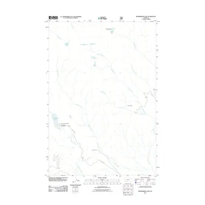
2011 Map of Mussigbrod Lake
USGS Topo · Published 2011About this map
Mussigbrod Lake and its surrounding high-country drainages define this portion of the Beaverhead-Deerlodge National Forest as it was documented in 2011. The landscape is characterized by a dense network of alpine water bodies, including Hope Lake, Crystal Lake, and Mystic Lake, with the latter supported by the Mystic Lake Forest Service Facility. Human presence is concentrated around the Mussigbrod Lake Dam, where the Mussigbrod Campground provides access to the water's edge via Mussigbrod Rd. Further south, the Spannuth Ranch stands as a notable private holding amidst the federal land. The map traces the intricate paths of Plimpton Creek and Thompson Creek as they navigate the glacial topography, including the broad basin of Clam Valley. This survey captures the region's character as a managed wilderness area, balancing ranching heritage with forest service infrastructure.
Find a feature on this map
21 named features on this map. Tap any name to fly to it.
Don’t see what you’re looking for? This feature index may not catch every label — zoom into the map to look around manually.
Map Details
Editions of this 2011 Mussigbrod Lake Map
This is the sole edition of this map. No revisions or reprints were ever made.
Other maps of this area

1955 · Dillon
USGS Topo · 1:250,000

1957 · Dillon
USGS Topo · 1:250,000

1958 · Dillon
USGS Topo · 1:250,000

1962 · Dillon
USGS Topo · 1:250,000

1962 · Mud Lake
USGS Topo · 1:24,000

1962 · Pintlar Lake
USGS Topo · 1:24,000
1962 · Warren Peak
USGS Topo · 1:24,000

1965 · Dillon
USGS Topo · 1:250,000

1966 · Gibbons School
USGS Topo · 1:24,000

1966 · Big Hole Battlefield
USGS Topo · 1:24,000