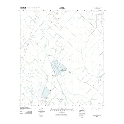
2010 Map of Mustang Bayou
USGS Topo · Published 2010About this map
Mustang Bayou and Chocolate Bayou wind through this coastal Texas landscape, defining a region where heavy industry and agriculture intersect. The southern portion of the map is dominated by large-scale infrastructure, including the Equistar Chemical Plant and the Amoco Chemical Company, alongside the Monsanto Reservoir Levee. These industrial landmarks sit adjacent to the Chocolate Bayou Oil Field, illustrating the economic engine of Brazoria County.
Find a feature on this map
43 named features on this map. Tap any name to fly to it.
Don’t see what you’re looking for? This feature index may not catch every label — zoom into the map to look around manually.
Map Details
Editions of this 2010 Mustang Bayou Map
This is the sole edition of this map. No revisions or reprints were ever made.
Other maps of this area

1929 · Dickinson
USGS Topo · 1:24,000

1929 · Karankawa Lake
USGS Topo · 1:24,000

1929 · Algoa
USGS Topo · 1:24,000

1929 · Hitchcock
USGS Topo · 1:24,000

1932 · Algoa
USGS Topo · 1:31,680

1932 · Dickinson
USGS Topo · 1:31,680

1932 · Hitchcock
USGS Topo · 1:31,680

1932 · Mustang Bayou
USGS Topo · 1:31,680

1933 · Karankawa Lake
USGS Topo · 1:31,680

1943 · Danbury
USGS Topo · 1:31,680