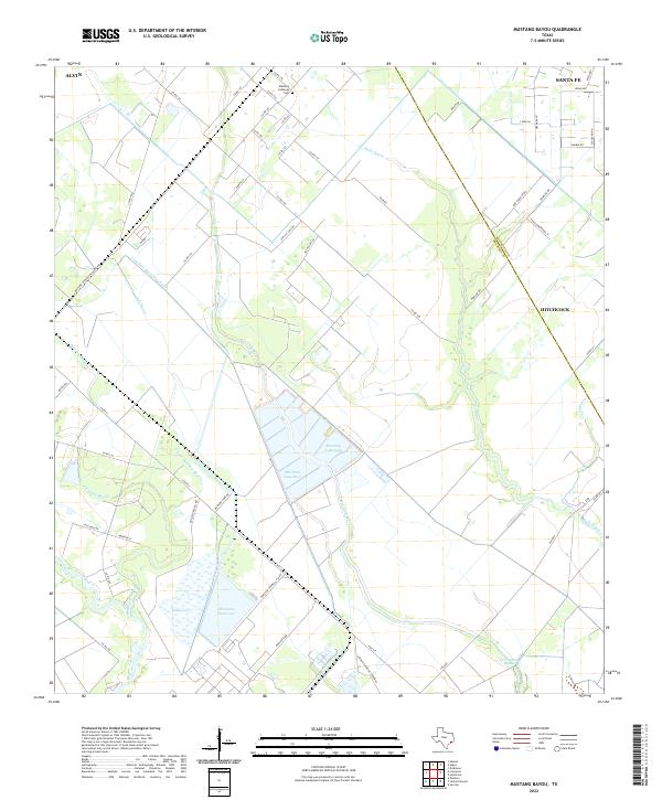
2022 Map of Mustang Bayou
USGS Topo · Published 2022About this map
Industrial and agricultural land uses converge along the Galveston Co and Brazoria Co boundary in this contemporary survey. Large-scale water management is evident through the presence of the Chocolate Bayou Rice Canal and the substantial Monsanto Reservoir, which sits adjacent to Duck Lake and the Amoco Chemical Company facility. The landscape is defined by a dense network of bayous, including the namesake Mustang Bayou, Halls Bayou, and Pleasant Bayou, illustrating the complex drainage of the Texas coastal plain. While portions of Alvin, Santa Fe, and Hitchcock appear at the margins, the interior is dominated by rural infrastructure and family-named landmarks like the Mustang Lutheran Cem. This map details the modern footprint of the petrochemical and rice-farming industries that have long shaped the region's economy and topography.
Find a feature on this map
61 named features on this map. Tap any name to fly to it.
Don’t see what you’re looking for? This feature index may not catch every label — zoom into the map to look around manually.
Map Details
Editions of this 2022 Mustang Bayou Map
This is the sole edition of this map. No revisions or reprints were ever made.
Other maps of this area

1929 · Dickinson
USGS Topo · 1:24,000

1929 · Karankawa Lake
USGS Topo · 1:24,000

1929 · Algoa
USGS Topo · 1:24,000

1929 · Hitchcock
USGS Topo · 1:24,000

1932 · Algoa
USGS Topo · 1:31,680

1932 · Dickinson
USGS Topo · 1:31,680

1932 · Hitchcock
USGS Topo · 1:31,680

1932 · Mustang Bayou
USGS Topo · 1:31,680

1933 · Karankawa Lake
USGS Topo · 1:31,680

1943 · Danbury
USGS Topo · 1:31,680