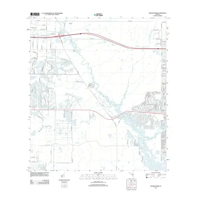
2012 Map of Myakka River
USGS Topo · Published 2012About this map
The Myakka River and its associated wetlands define the hydrology of this South Florida corridor during the early 21st century. The landscape is a study in contrasting land use, where the dense residential grid of North Port meets the sprawling, undeveloped reaches of the Deer Prairie Slough and Deer Prairie Cr. To the north, Manhattan Farms represents the area's agricultural legacy, while the expansion of the suburbs is visible through the extensive network of named streets like Woodland Blvd and Tropicaire Blvd. Significant water features such as Big Slough and Forked Cr intersect the region, illustrating the complex drainage patterns required for coastal development. This map documents the suburban footprint just before further intensification, preserving the layout of neighborhood entries like Venice Golf Club Dr and the preserved green space of Mesic Hammock Way.
Find a feature on this map
149 named features on this map. Tap any name to fly to it.
Don’t see what you’re looking for? This feature index may not catch every label — zoom into the map to look around manually.
Map Details
Editions of this 2012 Myakka River Map
This is the sole edition of this map. No revisions or reprints were ever made.
Other maps of this area

1943 · Laurel
USGS Topo · 1:24,000

1944 · Lower Myakka Lake
USGS Topo · 1:31,680

1944 · Myakka River
USGS Topo · 1:31,680

1944 · Laurel
USGS Topo · 1:31,680

1944 · Venice
USGS Topo · 1:31,680

1956 · Murdock
USGS Topo · 1:24,000

1956 · Murdock NW
USGS Topo · 1:24,000

1956 · Englewood
USGS Topo · 1:24,000

1956 · Tampa
USGS Topo · 1:250,000

1956 · Charlotte Harbor
USGS Topo · 1:250,000