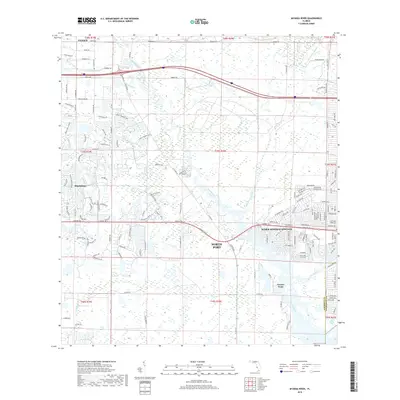
2018 Map of Myakka River
USGS Topo · Published 2018About this map
North Port and the surrounding Sarasota County landscape are defined by a complex network of waterways and residential growth in this 2018 survey. The Myakka River winds through the center of the sheet, joined by tributaries like Deer Prairie Creek and Big Slough. Significant development is visible in the eastern half of the map, particularly around Warm Mineral Springs, where the street grid fans out across the flat coastal plain. In contrast, the northwestern portion near Curry Creek and Deer Prairie Slough shows a more dispersed pattern of roads such as Border Rd and Forbes Trl. The map documents the meeting of natural drainage systems and modern municipal planning, showing how residential areas like Plantation and Tarpon Point integrate with the region's characteristic wetlands and creek beds.
Find a feature on this map
161 named features on this map. Tap any name to fly to it.
Don’t see what you’re looking for? This feature index may not catch every label — zoom into the map to look around manually.
Map Details
Editions of this 2018 Myakka River Map
This is the sole edition of this map. No revisions or reprints were ever made.
Other maps of this area

1943 · Laurel
USGS Topo · 1:24,000

1944 · Lower Myakka Lake
USGS Topo · 1:31,680

1944 · Myakka River
USGS Topo · 1:31,680

1944 · Laurel
USGS Topo · 1:31,680

1944 · Venice
USGS Topo · 1:31,680

1956 · Murdock
USGS Topo · 1:24,000

1956 · Murdock NW
USGS Topo · 1:24,000

1956 · Englewood
USGS Topo · 1:24,000

1956 · Tampa
USGS Topo · 1:250,000

1956 · Charlotte Harbor
USGS Topo · 1:250,000