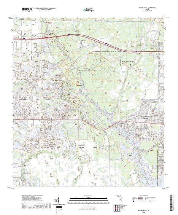
2024 Map of Myakka River
USGS Topo · Published 2024About this map
The Myakka River defines the central corridor of this coastal Florida landscape, winding southward through a network of preserves and residential developments toward the Gulf. To the east, the community of Warm Mineral Springs centers on its namesake thermal feature, while the sprawling footprint of North Port and the neighborhood of Plantation illustrate the modern suburban character of Sarasota County. The landscape is deeply tied to its hydrology, with Big Slough and Deer Prairie Creek feeding into the main river channel, creating a mosaic of wetlands and drainage patterns that dictate the layout of local roads.
Find a feature on this map
85 named features on this map. Tap any name to fly to it.
Don’t see what you’re looking for? This feature index may not catch every label — zoom into the map to look around manually.
Map Details
Editions of this 2024 Myakka River Map
This is the sole edition of this map. No revisions or reprints were ever made.
Other maps of this area

1943 · Laurel
USGS Topo · 1:24,000

1944 · Lower Myakka Lake
USGS Topo · 1:31,680

1944 · Myakka River
USGS Topo · 1:31,680

1944 · Laurel
USGS Topo · 1:31,680

1944 · Venice
USGS Topo · 1:31,680

1956 · Murdock
USGS Topo · 1:24,000

1956 · Murdock NW
USGS Topo · 1:24,000

1956 · Englewood
USGS Topo · 1:24,000

1956 · Tampa
USGS Topo · 1:250,000

1956 · Charlotte Harbor
USGS Topo · 1:250,000