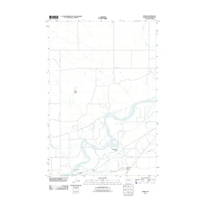
2011 Map of Myers
USGS Topo · Published 2011About this map
The Yellowstone River winds through the heart of Treasure County, defining the agricultural and transport corridor of the Myers area. This high-plains landscape is characterized by its reliance on water management, evidenced by the Hysham Main Canal and the Hysham Re-Lift Canal that parallel the river to support local ranching and farming operations. The small settlement of Myers and the nearby Myers Siding reflect the historical connection between the river valley and rail transport.
Find a feature on this map
21 named features on this map. Tap any name to fly to it.
Don’t see what you’re looking for? This feature index may not catch every label — zoom into the map to look around manually.
Map Details
Editions of this 2011 Myers Map
This is the sole edition of this map. No revisions or reprints were ever made.
Other maps of this area

1954 · Forsyth
USGS Topo · 1:250,000

1957 · Forsyth
USGS Topo · 1:250,000

1958 · Forsyth
USGS Topo · 1:250,000

1960 · Bighorn
USGS Topo · 1:24,000

1960 · Hysham
USGS Topo · 1:24,000

1960 · Steie Ranch
USGS Topo · 1:24,000

1960 · Ahles
USGS Topo · 1:24,000

1960 · Myers
USGS Topo · 1:24,000

1960 · Rancher Cemetery
USGS Topo · 1:24,000

1960 · Eldering Ranch
USGS Topo · 1:24,000