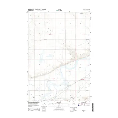
2014 Map of Myers
USGS Topo · Published 2014About this map
The Yellowstone River carves a deep valley through the high plains of Treasure County, defining the settlement and infrastructure of this rural corridor. In the river's fertile floodplain, the community of Pease Bottom sits north of the water, while the settlement of Myers serves as a local hub for the surrounding ranchlands. The landscape is characterized by significant topographic relief, with Guys Bluffs rising sharply above the southern bank and several drainage features like Buckingham Coulee and Antelope Coulee dissecting the terrain. Transport and water management are central to the area's development, evidenced by the Myers Bridge and Buckingham Coulee Bridge crossing the river and its tributaries. Extensive irrigation works, including the Hysham Main Canal and Hysham Re-Lift Canal, reveal the engineering required to sustain agriculture in this part of Montana.
Find a feature on this map
30 named features on this map. Tap any name to fly to it.
Don’t see what you’re looking for? This feature index may not catch every label — zoom into the map to look around manually.
Map Details
Editions of this 2014 Myers Map
This is the sole edition of this map. No revisions or reprints were ever made.
Other maps of this area

1954 · Forsyth
USGS Topo · 1:250,000

1957 · Forsyth
USGS Topo · 1:250,000

1958 · Forsyth
USGS Topo · 1:250,000

1960 · Bighorn
USGS Topo · 1:24,000

1960 · Hysham
USGS Topo · 1:24,000

1960 · Steie Ranch
USGS Topo · 1:24,000

1960 · Ahles
USGS Topo · 1:24,000

1960 · Myers
USGS Topo · 1:24,000

1960 · Rancher Cemetery
USGS Topo · 1:24,000

1960 · Eldering Ranch
USGS Topo · 1:24,000