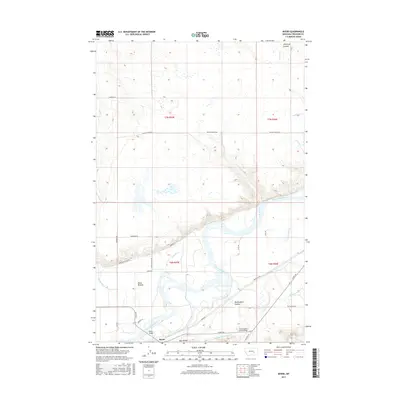
2017 Map of Myers
USGS Topo · Published 2017About this map
The Yellowstone River cuts a wide, winding path through this Treasure County landscape, defining the local geography and infrastructure. The small settlement of Myers serves as a focal point near the river's southern bank, where the Myers Bridge provides a vital crossing. This area is characterized by an extensive irrigation network essential for regional agriculture, featuring the Hysham Main Canal and the Hysham Re-Lift Canal. North of the river, the terrain is marked by numerous coulees and creeks, including Antelope Coulee, Cowen Cr, and McDonald Cr. Local ranching and land use are evident through named corridors like Grierson Ranch Ln and Mission Valley Rd, while landmarks such as Guys Bluffs and Buckingham Coulee provide distinct natural points of reference across the plains.
Find a feature on this map
32 named features on this map. Tap any name to fly to it.
Don’t see what you’re looking for? This feature index may not catch every label — zoom into the map to look around manually.
Map Details
Editions of this 2017 Myers Map
This is the sole edition of this map. No revisions or reprints were ever made.
Other maps of this area

1954 · Forsyth
USGS Topo · 1:250,000

1957 · Forsyth
USGS Topo · 1:250,000

1958 · Forsyth
USGS Topo · 1:250,000

1960 · Bighorn
USGS Topo · 1:24,000

1960 · Hysham
USGS Topo · 1:24,000

1960 · Steie Ranch
USGS Topo · 1:24,000

1960 · Ahles
USGS Topo · 1:24,000

1960 · Myers
USGS Topo · 1:24,000

1960 · Rancher Cemetery
USGS Topo · 1:24,000

1960 · Eldering Ranch
USGS Topo · 1:24,000