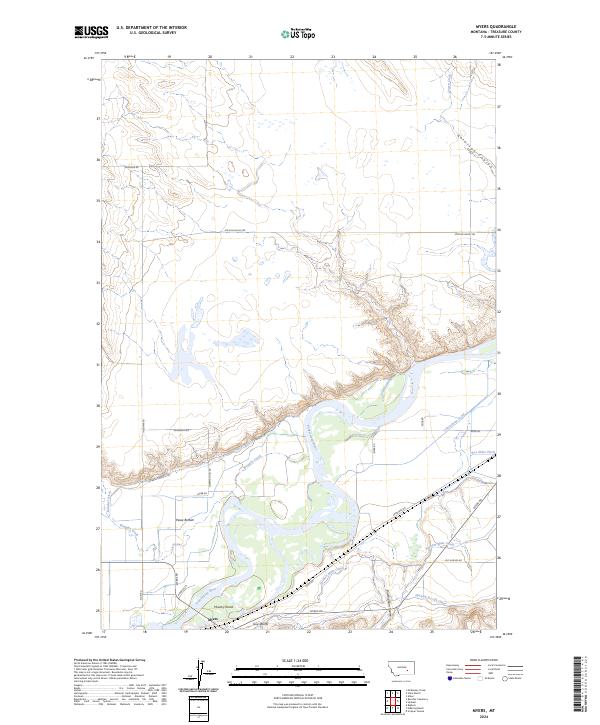
2024 Map of Myers
USGS Topo · Published 2024About this map
Yellowstone River hydraulics define the landscape of Treasure County on this recent survey, where the river's path is flanked by an extensive network of irrigation infrastructure. The small settlement of Myers serves as a focal point near the southern bank, situated just west of Guys Bluffs and south of the braided channels surrounding Howrey Island. The fertile valley floor, known as Pease Bottom, is interlaced with vital water management systems including the Hysham Main Canal, Yellowstone Canal, and Box Elder Ditch. To the north, the terrain transitions into a more arid landscape of intermittent drainages like Cowen Creek and deep incisions such as Antelope Coulee, showing the contrast between the managed riverfront and the open plains. Long-established ranch roads, including Ingomar Rd and Mission Valley Rd, connect the scattered homesteads across this Big Sky territory.
Find a feature on this map
31 named features on this map. Tap any name to fly to it.
Don’t see what you’re looking for? This feature index may not catch every label — zoom into the map to look around manually.
Map Details
Editions of this 2024 Myers Map
This is the sole edition of this map. No revisions or reprints were ever made.
Other maps of this area

1954 · Forsyth
USGS Topo · 1:250,000

1957 · Forsyth
USGS Topo · 1:250,000

1958 · Forsyth
USGS Topo · 1:250,000

1960 · Bighorn
USGS Topo · 1:24,000

1960 · Hysham
USGS Topo · 1:24,000

1960 · Steie Ranch
USGS Topo · 1:24,000

1960 · Ahles
USGS Topo · 1:24,000

1960 · Myers
USGS Topo · 1:24,000

1960 · Rancher Cemetery
USGS Topo · 1:24,000

1960 · Eldering Ranch
USGS Topo · 1:24,000