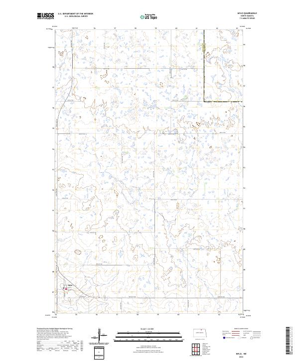
2024 Map of Mylo
USGS Topo · Published 2024About this map
The small settlement of Mylo anchors the southwestern corner of this prairie landscape, where the local post office Po serves as a vital community node. Positioned along the border of Rolette Co Towner Co, the area is defined by a grid-like network of rural roads such as Airport Rd, 51ST Ave NE, and 84th St NE. This layout reflects the systematic land divisions of the Public Land Survey System, specifically across townships like t160n r69w and t161n r69w. The terrain is dominated by numerous small wetlands and glacial potholes typical of the North Dakota plains, punctuated by Main St in the heart of the townsite. This map provides a clear view of the intersection between agricultural land management and small-town infrastructure in the modern era.
Find a feature on this map
24 named features on this map. Tap any name to fly to it.
Don’t see what you’re looking for? This feature index may not catch every label — zoom into the map to look around manually.
Map Details
Editions of this 2024 Mylo Map
This is the sole edition of this map. No revisions or reprints were ever made.
Other maps of this area

1953 · Devils Lake
USGS Topo · 1:250,000

1956 · Devils Lake
USGS Topo · 1:250,000

1968 · Belcourt
USGS Topo · 1:24,000

1970 · Hansboro SW
USGS Topo · 1:24,000

1970 · Rolla
USGS Topo · 1:24,000

1971 · Bisbee South
USGS Topo · 1:24,000

1971 · Island Lake
USGS Topo · 1:24,000

1971 · Mylo
USGS Topo · 1:24,000

1971 · Bisbee North
USGS Topo · 1:24,000

1971 · Mylo NW
USGS Topo · 1:24,000