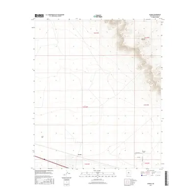
2017 Map of Myndus
USGS Topo · Published 2017About this map
The settlement of Myndus sits along the southern transport corridor of this Luna County landscape, where the flat desert floor transitions into the elevated terrain of the Good Sight Mountains. This 2017 survey by the U.S. Geological Survey illustrates a region defined by sparse development and expansive horizons, characterized by features like the broad expanse of Lewis Flats. Aviation infrastructure is a notable component of the local geography, evidenced by the Solo Ranch Airport and its accompanying Solo Runway SE. The network of local roads, including Cheyenne and Good Sight Rd SE, provides the primary access to the isolated ranching and utility sites that populate this arid New Mexico quadrangle.
Find a feature on this map
13 named features on this map. Tap any name to fly to it.
Don’t see what you’re looking for? This feature index may not catch every label — zoom into the map to look around manually.
Map Details
Editions of this 2017 Myndus Map
This is the sole edition of this map. No revisions or reprints were ever made.
Other maps of this area

1899 · Deming
USGS Topo · 1:125,000

1915 · Deming
USGS Topo · 1:125,000

1955 · Las Cruces
USGS Topo · 1:250,000

1958 · Las Cruces
USGS Topo · 1:250,000

1964 · Florida
USGS Topo · 1:24,000

1964 · Florida Gap
USGS Topo · 1:24,000

1965 · Carne
USGS Topo · 1:24,000

1972 · Myndus
USGS Topo · 1:24,000

1972 · Cambray
USGS Topo · 1:24,000

1972 · Good Sight Peak NE
USGS Topo · 1:24,000