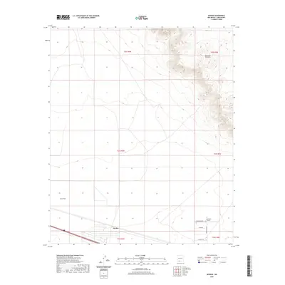
2020 Map of Myndus
USGS Topo · Published 2020About this map
The high desert terrain of Luna County is anchored here by the Good Sight Mountains and the sweeping reach of Lewis Flats. In the southern portion of the quadrangle, the small settlement of Myndus sits along a major transportation corridor, reflecting the infrastructure typical of this arid region. Aviation interests are represented by the Solo Ranch Airport, with its designated Solo Runway SE. The landscape is further defined by a grid of rural roads including Cheyenne, Good Sight Rd SE, and Apache Rd Se. These features together illustrate a sparsely populated area where cattle ranching and light aviation dominate the local economy and land use patterns.
Find a feature on this map
14 named features on this map. Tap any name to fly to it.
Don’t see what you’re looking for? This feature index may not catch every label — zoom into the map to look around manually.
Map Details
Editions of this 2020 Myndus Map
This is the sole edition of this map. No revisions or reprints were ever made.
Other maps of this area

1899 · Deming
USGS Topo · 1:125,000

1915 · Deming
USGS Topo · 1:125,000

1955 · Las Cruces
USGS Topo · 1:250,000

1958 · Las Cruces
USGS Topo · 1:250,000

1964 · Florida
USGS Topo · 1:24,000

1964 · Florida Gap
USGS Topo · 1:24,000

1965 · Carne
USGS Topo · 1:24,000

1972 · Myndus
USGS Topo · 1:24,000

1972 · Cambray
USGS Topo · 1:24,000

1972 · Good Sight Peak NE
USGS Topo · 1:24,000