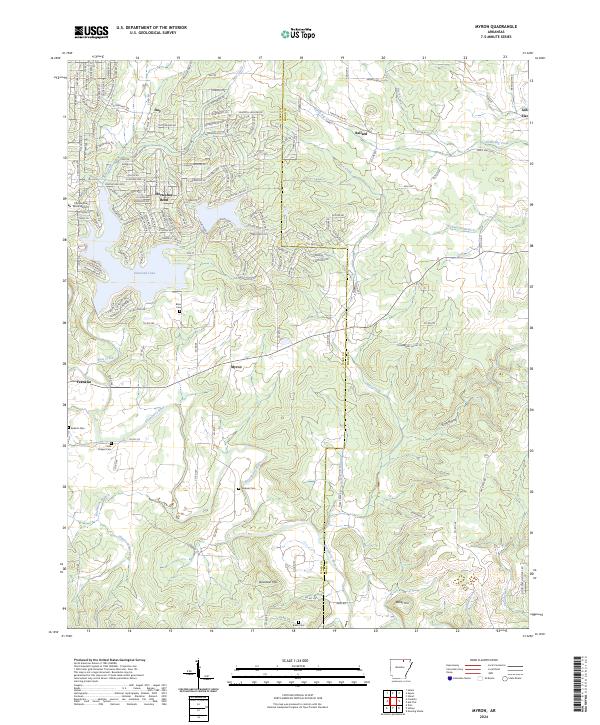
2024 Map of Myron
USGS Topo · Published 2024About this map
Strawberry River meanders across this northern Arkansas landscape, defining the topography between the settlements of Myron and Franklin. The area is characterized by high ridges such as Davidson Hill and Baker Hill, with the southern reaches of Horseshoe Bend showing a dense network of residential streets and the waters of Diamond Lake. Genealogists will find a significant number of family and community burial grounds documented, including Bates Cem, Godwin Cem, and Hills Chapel Cem. The transition from the developed leisure corridors around Horseshoe Bend to the more traditional rural patterns of Ballard and Ash Flat is clearly visible. Numerous smaller tributaries like Bens Creek and Hans Creek carve through the terrain, while local industry is represented by a Gravel Pit near the northern boundary. The map captures the boundary between Izard and Sharp counties, showing how the road network and waterways bridge these local jurisdictions.
Find a feature on this map
160 named features on this map. Tap any name to fly to it.
Don’t see what you’re looking for? This feature index may not catch every label — zoom into the map to look around manually.
Map Details
Editions of this 2024 Myron Map
This is the sole edition of this map. No revisions or reprints were ever made.
Other maps of this area

1950 · Salem
USGS Topo · 1:62,500

1951 · Salem
USGS Topo · 1:62,500

1951 · Melbourne
USGS Topo · 1:62,500

1957 · Poplar Bluff
USGS Topo · 1:250,000

1959 · Poplar Bluff
USGS Topo · 1:250,000

1960 · Poplar Bluff
USGS Topo · 1:250,000
1961 · Evening Shade
USGS Topo · 1:24,000

1962 · Stuart
USGS Topo · 1:24,000

1962 · Ash Flat
USGS Topo · 1:24,000
1962 · Sidney
USGS Topo · 1:24,000