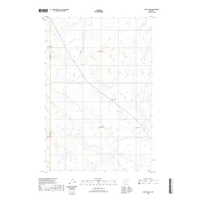
2020 Map of N Bar Coulee
USGS Topo · Published 2020About this map
Crow Rock Rd cuts a diagonal path through this Montana landscape, marking the primary route through an area defined by deep drainages and cattle country. The terrain is centered around the eponymous N Bar Coulee and Owens Coulee, which channel seasonal water toward the larger winding system of North Sunday Creek. This contemporary survey illustrates the complex hydrology of the high plains, where named watercourses like Bow and Arrow Cr, Grimes Cr, and Alkali Cr carve through the sections of Rosebud and Custer counties. This rural expanse, divided into township and range grids, reveals the persistent patterns of land use and property boundaries in a region where water sources dictate the names on the land.
Find a feature on this map
13 named features on this map. Tap any name to fly to it.
Don’t see what you’re looking for? This feature index may not catch every label — zoom into the map to look around manually.
Map Details
Editions of this 2020 N Bar Coulee Map
This is the sole edition of this map. No revisions or reprints were ever made.
Other maps of this area

1953 · Miles City
USGS Topo · 1:250,000

1954 · Forsyth
USGS Topo · 1:250,000

1957 · Miles City
USGS Topo · 1:250,000

1957 · Forsyth
USGS Topo · 1:250,000

1958 · Miles City
USGS Topo · 1:250,000

1958 · Forsyth
USGS Topo · 1:250,000

1968 · Big Hill
USGS Topo · 1:24,000

1968 · Butterfly Creek
USGS Topo · 1:24,000

1968 · Hathaway NW
USGS Topo · 1:24,000

1969 · Horse Creek Hill
USGS Topo · 1:24,000