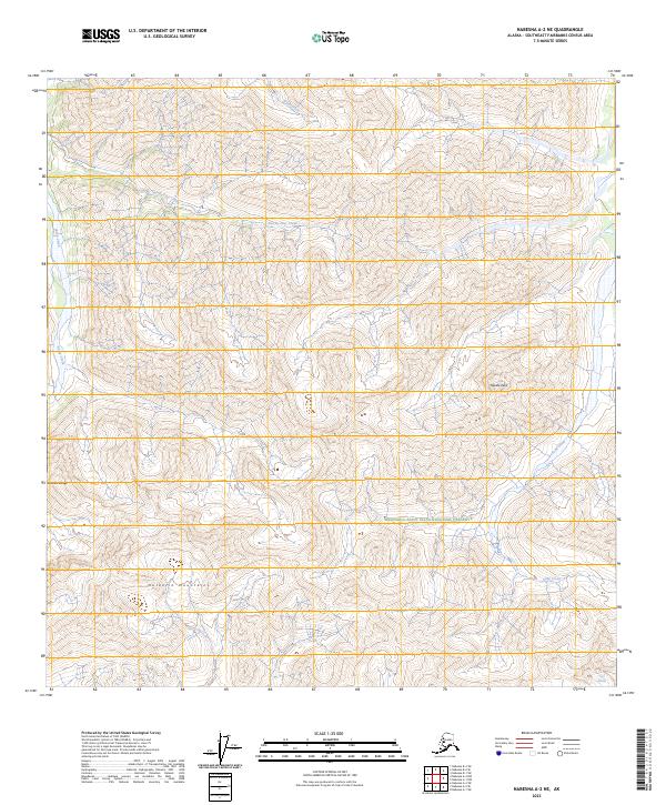
2023 Map of Nabesna A-2 NE
USGS Topo · Published 2023About this map
The Nutzotin Mountains dominate this high-altitude landscape within the Wrangell-Saint Elias National Preserve, where the southern peaks reach toward the Carl Glacier. This 2023 survey documents a wilderness of sharp elevation changes and glacial runoff, with Needle Peak standing as a central landmark above the converging drainages of Snag Creek and Two-by-Four Creek. The terrain reflects the transition from the eastern Alaska Range into the vast river systems of the Southeast Fairbanks Census Area. Evidence of seasonal water flow is found in the northern drainages of Bruin Creek and Sheep Creek, illustrating the natural hydrological patterns of this remote interior region before it crosses toward the international border.
Find a feature on this map
13 named features on this map. Tap any name to fly to it.
Don’t see what you’re looking for? This feature index may not catch every label — zoom into the map to look around manually.
Map Details
Editions of this 2023 Nabesna A-2 NE Map
This is the sole edition of this map. No revisions or reprints were ever made.
Other maps of this area

1950 · Nabesna
USGS Topo · 1:250,000

1951 · Nabesna
USGS Topo · 1:250,000

1959 · Nabesna A-1
USGS Topo · 1:63,360

1960 · Nabesna A-2
USGS Topo · 1:63,360

1960 · Nabesna B-2
USGS Topo · 1:63,360

1960 · Nabesna
USGS Topo · 1:250,000

1960 · Nabesna B-1
USGS Topo · 1:63,360
2016 · Nabesna A-2 NE
USGS Topo · 1:25,000
2016 · Nabesna B-2 SE
USGS Topo · 1:25,000
2016 · Nabesna B-2 SW
USGS Topo · 1:25,000