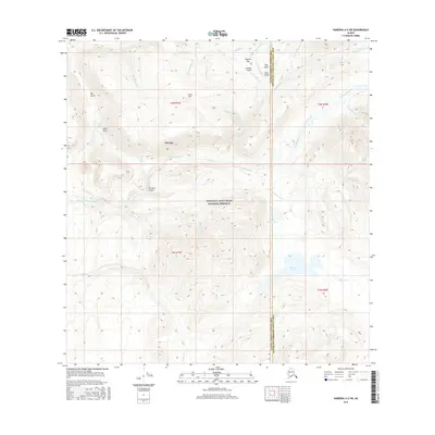
2016 Map of Nabesna A-2 SW
USGS Topo · Published 2016About this map
Chisana stands as the primary human settlement in this remote landscape, situated near the headwaters of Chathenda Creek and the southern slopes of Gold Hill. This high-altitude region is dominated by the Wrangell-Saint Elias National Preserve, where the topography is defined by a dense network of watercourses and named gulches that reflect early 20th-century prospecting activity. The map reveals a complex drainage system including Bonanza Creek, Poorman Cr, and Gold Run Cr, all of which converge beneath ridges like Caribou Pass.
Find a feature on this map
38 named features on this map. Tap any name to fly to it.
Don’t see what you’re looking for? This feature index may not catch every label — zoom into the map to look around manually.
Map Details
Editions of this 2016 Nabesna A-2 SW Map
This is the sole edition of this map. No revisions or reprints were ever made.
Other maps of this area

1950 · Nabesna
USGS Topo · 1:250,000

1951 · McCarthy
USGS Topo · 1:250,000

1951 · Nabesna
USGS Topo · 1:250,000

1959 · McCarthy D-3
USGS Topo · 1:63,360

1959 · McCarthy D-2
USGS Topo · 1:63,360

1960 · Nabesna A-3
USGS Topo · 1:63,360

1960 · Nabesna A-2
USGS Topo · 1:63,360

1960 · Nabesna
USGS Topo · 1:250,000

1960 · McCarthy
USGS Topo · 1:250,000
2016 · Nabesna A-2 NE
USGS Topo · 1:25,000