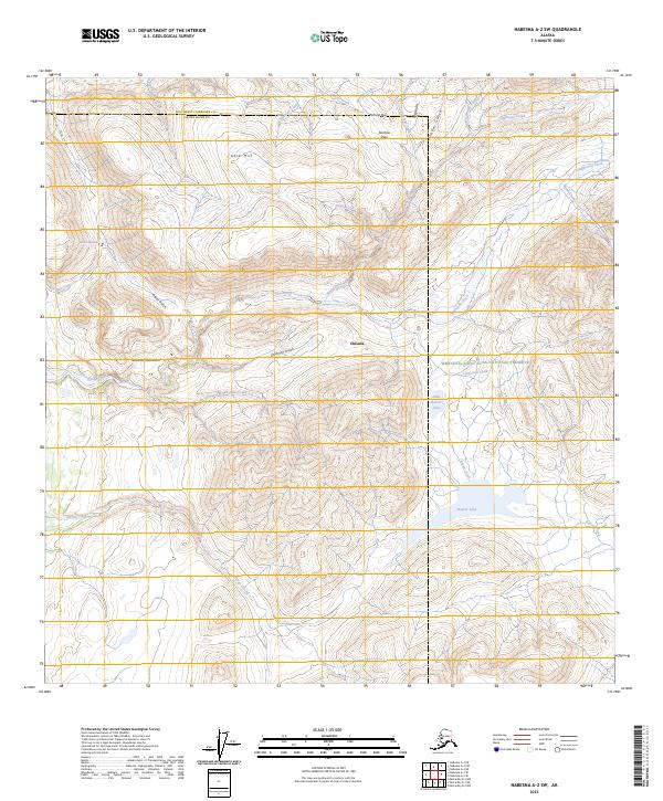
2023 Map of Nabesna A-2 SW
USGS Topo · Published 2023About this map
Chisana sits at the heart of this landscape, a place deeply tied to the early 20th-century gold rushes of interior Alaska. The map traces the rugged drainage patterns of the Nutzotin Mountains, where watercourses like Gold Run Creek and Bonanza Creek indicate the historic prospecting activity that once drew thousands to this remote district. Much of the southern and eastern portions of the quadrangle are now protected within the Wrangell-St. Elias Wilderness and the Wrangell-Saint Elias National Preserve, securing a terrain of high ridges and narrow gulches. High-altitude crossings such as Caribou Pass and prominent landmarks like Gold Hill overlook a network of alpine streams including Big Eldorado Creek and Chathenda Creek. The presence of Little Beaver Lake and the larger Beaver Lake in the southeast provides a distinct contrast to the steep, narrow gullies like Dick Gulch and Snow Gulch found further north.
Find a feature on this map
37 named features on this map. Tap any name to fly to it.
Don’t see what you’re looking for? This feature index may not catch every label — zoom into the map to look around manually.
Map Details
Editions of this 2023 Nabesna A-2 SW Map
This is the sole edition of this map. No revisions or reprints were ever made.
Other maps of this area

1950 · Nabesna
USGS Topo · 1:250,000

1951 · McCarthy
USGS Topo · 1:250,000

1951 · Nabesna
USGS Topo · 1:250,000

1959 · McCarthy D-3
USGS Topo · 1:63,360

1959 · McCarthy D-2
USGS Topo · 1:63,360

1960 · Nabesna A-3
USGS Topo · 1:63,360

1960 · Nabesna A-2
USGS Topo · 1:63,360

1960 · Nabesna
USGS Topo · 1:250,000

1960 · McCarthy
USGS Topo · 1:250,000
2016 · Nabesna A-2 NE
USGS Topo · 1:25,000