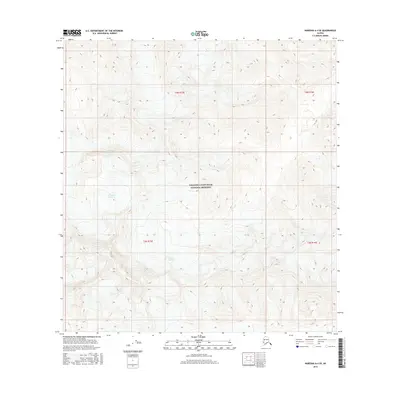
2016 Map of Nabesna A-4 SE
USGS Topo · Published 2016About this map
Wrangell-Saint Elias National Preserve encompasses a dramatic glacial landscape in this high-altitude Alaska survey. The massive Nikonda Glacier dominates the northwestern portion of the map, while the Cross Cr Glacier feeds into the winding headwaters of Cross Cr further south. These features illustrate the active glacial systems and high-alpine drainage patterns that define this interior region. The terrain is marked by steep elevation changes, with numerous peaks and ridges captured through detailed contour lines. This 2016 production reflects modern mapping efforts in one of the most protected and inaccessible reaches of the state, focusing on the preservation of these natural geological formations rather than human settlement or infrastructure.
Find a feature on this map
10 named features on this map. Tap any name to fly to it.
Don’t see what you’re looking for? This feature index may not catch every label — zoom into the map to look around manually.
Map Details
Editions of this 2016 Nabesna A-4 SE Map
This is the sole edition of this map. No revisions or reprints were ever made.
Other maps of this area

1950 · Nabesna
USGS Topo · 1:250,000

1951 · McCarthy
USGS Topo · 1:250,000

1951 · Nabesna
USGS Topo · 1:250,000

1959 · Nabesna A-4
USGS Topo · 1:63,360

1960 · Nabesna A-3
USGS Topo · 1:63,360

1960 · Nabesna
USGS Topo · 1:250,000
1960 · McCarthy D-5
USGS Topo · 1:63,360

1960 · McCarthy D-4
USGS Topo · 1:63,360

1960 · McCarthy
USGS Topo · 1:250,000
2016 · Nabesna A-4 NW
USGS Topo · 1:25,000