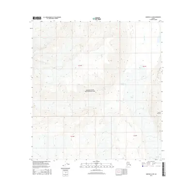
2016 Map of Nabesna A-6 NW
USGS Topo · Published 2016About this map
Wrangell-Saint Elias National Park encompasses the vast majority of this 2016 survey, showcasing a landscape defined by glacial activity and high mountain terrain. The eastern edge of the map follows the course of the Copper River, fed by the massive Copper Glacier flowing down from the slopes of the Wrangell Mountains. To the northwest, the smaller W Glacier sits among high-altitude contours, illustrating the complex hydrography of this protected wilderness. The absence of roads or settlements highlights the isolation of this portion of the park, where the terrain is governed entirely by natural forces. Surveyed townships like t5n r8e and t5n r9e provide a grid for this otherwise wild expanse, offering a precise view of the physical geography within one of America's largest national parks.
Find a feature on this map
9 named features on this map. Tap any name to fly to it.
Don’t see what you’re looking for? This feature index may not catch every label — zoom into the map to look around manually.
Map Details
Editions of this 2016 Nabesna A-6 NW Map
This is the sole edition of this map. No revisions or reprints were ever made.
Other maps of this area

1950 · Nabesna
USGS Topo · 1:250,000

1951 · Gulkana
USGS Topo · 1:250,000

1951 · Nabesna
USGS Topo · 1:250,000

1959 · Gulkana B-1
USGS Topo · 1:63,360
1959 · Gulkana A-1
USGS Topo · 1:63,360

1959 · Gulkana
USGS Topo · 1:250,000

1959 · Nabesna A-6
USGS Topo · 1:63,360

1960 · Nabesna
USGS Topo · 1:250,000
1960 · Nabesna B-6
USGS Topo · 1:63,360

1965 · Gulkana
USGS Topo · 1:250,000