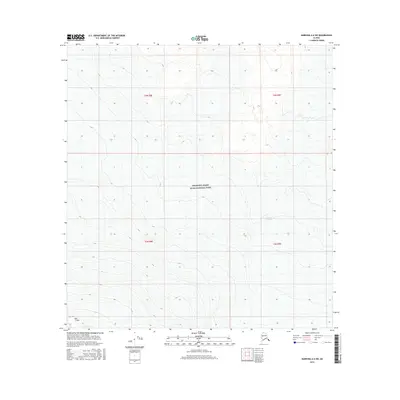
2016 Map of Nabesna A-6 SW
USGS Topo · Published 2016About this map
Wrangell-Saint Elias National Park dominates this landscape, showing a high-altitude wilderness defined by glacial activity and volcanic geology. The map provides a detailed view of the ice fields and surrounding terrain in the early 21st century, specifically highlighting the Copper Glacier as it descends from the surrounding peaks. In the southwestern corner, the distinctive geological profile of East Crater sits adjacent to the sprawling Long Glacier, illustrating the complex relationship between volcanic features and the ice that shapes them. This survey serves as a precise record of the frozen hydrography and public land boundaries within the Unorganized Borough, capturing the reach of these named glaciers before further seasonal or climatic shifts occurred.
Find a feature on this map
9 named features on this map. Tap any name to fly to it.
Don’t see what you’re looking for? This feature index may not catch every label — zoom into the map to look around manually.
Map Details
Editions of this 2016 Nabesna A-6 SW Map
This is the sole edition of this map. No revisions or reprints were ever made.
Other maps of this area

1950 · Nabesna
USGS Topo · 1:250,000

1951 · McCarthy
USGS Topo · 1:250,000

1951 · Gulkana
USGS Topo · 1:250,000

1951 · Nabesna
USGS Topo · 1:250,000

1952 · Valdez
USGS Topo · 1:250,000
1959 · Gulkana A-1
USGS Topo · 1:63,360

1959 · Gulkana
USGS Topo · 1:250,000

1959 · Nabesna A-6
USGS Topo · 1:63,360

1959 · Valdez D-1
USGS Topo · 1:63,360

1960 · McCarthy D-8
USGS Topo · 1:63,360