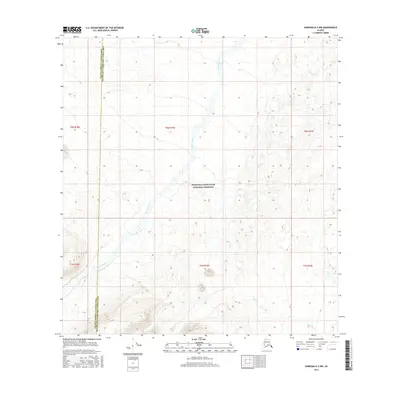
2016 Map of Nabesna B-2 NW
USGS Topo · Published 2016About this map
Wrangell-Saint Elias National Preserve encompasses much of this interior Alaskan landscape, characterized by high-elevation terrain and isolated drainage systems. The northern reaches of the quadrangle are defined by the winding course of Stuver Creek, which flows through deep glacial valleys. Further south, the headwaters of Edge Cr emerge from the steep slopes of the eastern mountains. This 2016 survey captures the area as it straddles the boundary between the Valdez-Cordova Census Area and the Southeast Fairbanks Census Area. The map reveals a land of extreme relief, where narrow ridgelines and alpine basins remain largely untouched by permanent settlement or infrastructure, providing a detailed record of the natural hydrology and topographical contours within one of the nation's most remote protected wildernesses.
Find a feature on this map
10 named features on this map. Tap any name to fly to it.
Don’t see what you’re looking for? This feature index may not catch every label — zoom into the map to look around manually.
Map Details
Editions of this 2016 Nabesna B-2 NW Map
This is the sole edition of this map. No revisions or reprints were ever made.
Other maps of this area

1950 · Nabesna
USGS Topo · 1:250,000

1951 · Nabesna
USGS Topo · 1:250,000

1954 · Nabesna C-3
USGS Topo · 1:63,360

1955 · Nabesna C-2
USGS Topo · 1:63,360

1955 · Nabesna C-3
USGS Topo · 1:63,360

1960 · Nabesna B-2
USGS Topo · 1:63,360

1960 · Nabesna
USGS Topo · 1:250,000

1960 · Nabesna B-3
USGS Topo · 1:63,360
2016 · Nabesna B-2 NE
USGS Topo · 1:25,000
2016 · Nabesna C-2 SE
USGS Topo · 1:25,000