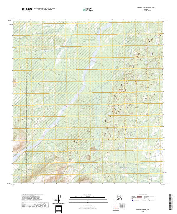
2023 Map of Nabesna B-2 NW
USGS Topo · Published 2023About this map
The Wrangell-Saint Elias National Preserve dominates this portion of the interior, where the landscape is defined by the high elevations of the Nutzotin Mountains along the southern border. This 2023 survey by the U.S. Geological Survey documents the remote drainage patterns of the region, specifically following the course of Stuver Creek as it flows north through the preserve. The boundary between Copper River Co and Southeast Fairbanks Co cuts through the western edge of the sheet, providing a precise record of administrative divisions in this largely untouched terrain. The map also traces the headwaters of Edge Creek in the southeast, offering a clear view of the complex topography and natural hydrology that characterizes this section of the Alaskan wilderness before any modern infrastructure development.
Find a feature on this map
11 named features on this map. Tap any name to fly to it.
Don’t see what you’re looking for? This feature index may not catch every label — zoom into the map to look around manually.
Map Details
Editions of this 2023 Nabesna B-2 NW Map
This is the sole edition of this map. No revisions or reprints were ever made.
Other maps of this area

1950 · Nabesna
USGS Topo · 1:250,000

1951 · Nabesna
USGS Topo · 1:250,000

1954 · Nabesna C-3
USGS Topo · 1:63,360

1955 · Nabesna C-2
USGS Topo · 1:63,360

1955 · Nabesna C-3
USGS Topo · 1:63,360

1960 · Nabesna B-2
USGS Topo · 1:63,360

1960 · Nabesna
USGS Topo · 1:250,000

1960 · Nabesna B-3
USGS Topo · 1:63,360
2016 · Nabesna B-2 NE
USGS Topo · 1:25,000
2016 · Nabesna C-2 SE
USGS Topo · 1:25,000