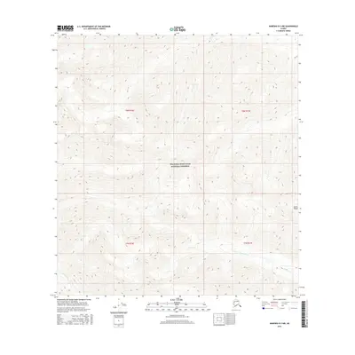
2016 Map of Nabesna B-3 NW
USGS Topo · Published 2016About this map
Wrangell-Saint Elias National Preserve encompasses the vast majority of this 2016 survey, representing a landscape defined by the high-elevation reaches of the Alaska Range. This terrain is characterized by a dense network of glacial and snowmelt drainages that feed into larger systems such as Antler Creek (also labeled as Antler Cr in its upper sections) and Stone Creek. The map reflects a modern preservation era where land use is defined by federal conservation boundaries rather than permanent human settlement. The topographic data captures the intricate ridge lines and steep elevation changes within the Wrangell Mountains, where the lack of roads or infrastructure highlights the wild character of this corner of the Unorganized Borough.
Find a feature on this map
9 named features on this map. Tap any name to fly to it.
Don’t see what you’re looking for? This feature index may not catch every label — zoom into the map to look around manually.
Map Details
Editions of this 2016 Nabesna B-3 NW Map
This is the sole edition of this map. No revisions or reprints were ever made.
Other maps of this area

1950 · Nabesna
USGS Topo · 1:250,000

1951 · Nabesna
USGS Topo · 1:250,000

1954 · Nabesna C-3
USGS Topo · 1:63,360

1955 · Nabesna C-3
USGS Topo · 1:63,360

1960 · Nabesna B-4
USGS Topo · 1:63,360

1960 · Nabesna
USGS Topo · 1:250,000

1960 · Nabesna C-4
USGS Topo · 1:63,360

1960 · Nabesna B-3
USGS Topo · 1:63,360
2016 · Nabesna B-3 SE
USGS Topo · 1:25,000
2016 · Nabesna B-4 SE
USGS Topo · 1:25,000