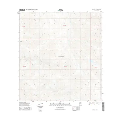
2016 Map of Nabesna B-4 SE
USGS Topo · Published 2016About this map
The Wrangell-Saint Elias National Preserve encompasses most of this landscape, reflecting a protected wilderness in the eastern interior of Alaska. The high elevations of the Wrangell Mountains dominate the terrain, where sharp contour lines trace the steep ascent of the northern slopes. Waterways such as Cooper Creek and Ninemile Cr carve through the drainage basins, creating a natural network of seasonal and perennial flows that feed into the larger regional systems.
Find a feature on this map
13 named features on this map. Tap any name to fly to it.
Don’t see what you’re looking for? This feature index may not catch every label — zoom into the map to look around manually.
Map Details
Editions of this 2016 Nabesna B-4 SE Map
This is the sole edition of this map. No revisions or reprints were ever made.
Other maps of this area

1950 · Nabesna
USGS Topo · 1:250,000

1951 · Nabesna
USGS Topo · 1:250,000

1959 · Nabesna A-4
USGS Topo · 1:63,360

1960 · Nabesna B-4
USGS Topo · 1:63,360

1960 · Nabesna A-3
USGS Topo · 1:63,360

1960 · Nabesna
USGS Topo · 1:250,000

1960 · Nabesna B-3
USGS Topo · 1:63,360
2016 · Nabesna A-4 NW
USGS Topo · 1:25,000
2016 · Nabesna B-4 NW
USGS Topo · 1:25,000
2016 · Nabesna A-4 NE
USGS Topo · 1:25,000