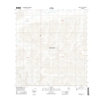
2016 Map of Nabesna B-3 SE
USGS Topo · Published 2016About this map
Wrangell-Saint Elias National Preserve encompasses the vast majority of this 2016 survey, a landscape defined by the high-elevation peaks of the Nutzotin Mountains. The topography is dominated by steep, complex contouring that rises from the drainage basins of Stuver Creek and its tributary, Antler Cr, which flow through the northern reaches of the quadrangle. As part of a protected wilderness area, the map shows no permanent human settlements or roads, offering instead a pure documentation of the hydrography and elevation within the Unorganized Borough. The precision of the 1:25,000 scale provides a detailed view of the natural watercourses as they navigate the high-mountain terrain, marking a preserved Alaskan environment where the land remains largely untouched by industrial or residential development.
Find a feature on this map
9 named features on this map. Tap any name to fly to it.
Don’t see what you’re looking for? This feature index may not catch every label — zoom into the map to look around manually.
Map Details
Editions of this 2016 Nabesna B-3 SE Map
This is the sole edition of this map. No revisions or reprints were ever made.
Other maps of this area

1950 · Nabesna
USGS Topo · 1:250,000

1951 · Nabesna
USGS Topo · 1:250,000

1960 · Nabesna A-3
USGS Topo · 1:63,360

1960 · Nabesna A-2
USGS Topo · 1:63,360

1960 · Nabesna B-2
USGS Topo · 1:63,360

1960 · Nabesna
USGS Topo · 1:250,000

1960 · Nabesna B-3
USGS Topo · 1:63,360
2016 · Nabesna B-2 SW
USGS Topo · 1:25,000
2016 · Nabesna B-2 NW
USGS Topo · 1:25,000
2016 · Nabesna A-2 NW
USGS Topo · 1:25,000