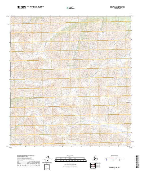
2023 Map of Nabesna B-3 NW
USGS Topo · Published 2023About this map
The Wrangell-Saint Elias National Preserve encompasses most of this high-elevation landscape, where the jagged peaks of the Nutzotin Mountains meet the southeastern reaches of the Alaska Range. In this remote interior, the map documents a terrain defined by steep contour lines and glacial drainages, lacking any permanent roads or settlements. The drainage patterns of Antler Creek and Stone Creek illustrate the classic braided stream morphology of the subarctic, moving meltwater through the deep valleys of the Nabesna region. This map serves as a contemporary record of an unpopulated wilderness where the topography remains the primary feature for navigation and study.
Find a feature on this map
9 named features on this map. Tap any name to fly to it.
Don’t see what you’re looking for? This feature index may not catch every label — zoom into the map to look around manually.
Map Details
Editions of this 2023 Nabesna B-3 NW Map
This is the sole edition of this map. No revisions or reprints were ever made.
Other maps of this area

1950 · Nabesna
USGS Topo · 1:250,000

1951 · Nabesna
USGS Topo · 1:250,000

1954 · Nabesna C-3
USGS Topo · 1:63,360

1955 · Nabesna C-3
USGS Topo · 1:63,360

1960 · Nabesna B-4
USGS Topo · 1:63,360

1960 · Nabesna
USGS Topo · 1:250,000

1960 · Nabesna C-4
USGS Topo · 1:63,360

1960 · Nabesna B-3
USGS Topo · 1:63,360
2016 · Nabesna B-3 SE
USGS Topo · 1:25,000
2016 · Nabesna B-4 SE
USGS Topo · 1:25,000