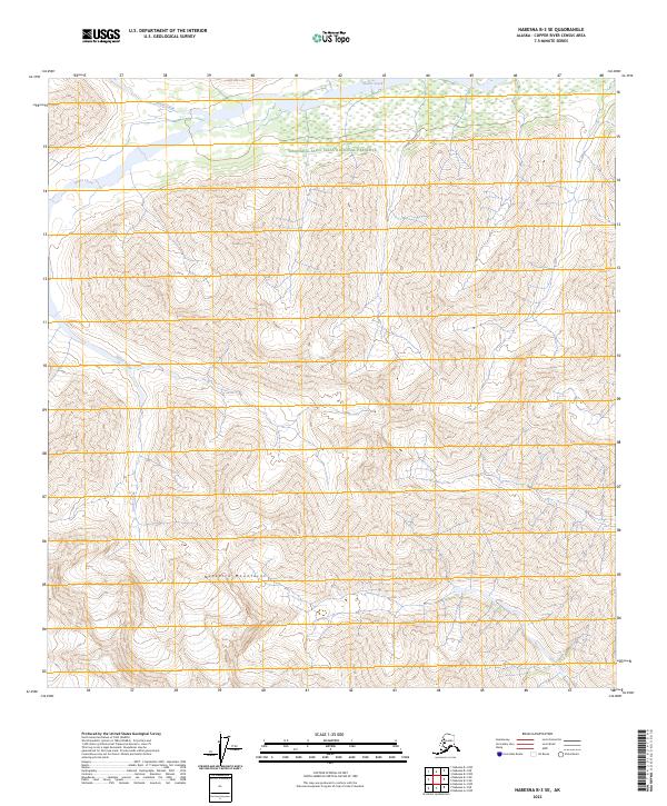
2023 Map of Nabesna B-3 SE
USGS Topo · Published 2023About this map
The Nutzotin Mountains dominate this high-latitude terrain, where steep contour lines reveal the dramatic verticality of the northern landscape. Most of this area is protected within the Wrangell-Saint Elias National Preserve, a designation that indicates a land largely untouched by permanent settlement or industrial infrastructure. The drainage patterns are defined by the cold waters of Stuver Creek and Antler Creek, which carve through the valleys between high peaks. This map provides a look at the natural hydrology and land divisions, including t7n r17e and t6n r18e, in a region where the geography itself remains the primary feature of record.
Find a feature on this map
8 named features on this map. Tap any name to fly to it.
Don’t see what you’re looking for? This feature index may not catch every label — zoom into the map to look around manually.
Map Details
Editions of this 2023 Nabesna B-3 SE Map
This is the sole edition of this map. No revisions or reprints were ever made.
Other maps of this area

1950 · Nabesna
USGS Topo · 1:250,000

1951 · Nabesna
USGS Topo · 1:250,000

1960 · Nabesna A-3
USGS Topo · 1:63,360

1960 · Nabesna A-2
USGS Topo · 1:63,360

1960 · Nabesna B-2
USGS Topo · 1:63,360

1960 · Nabesna
USGS Topo · 1:250,000

1960 · Nabesna B-3
USGS Topo · 1:63,360
2016 · Nabesna B-2 SW
USGS Topo · 1:25,000
2016 · Nabesna B-2 NW
USGS Topo · 1:25,000
2016 · Nabesna A-2 NW
USGS Topo · 1:25,000