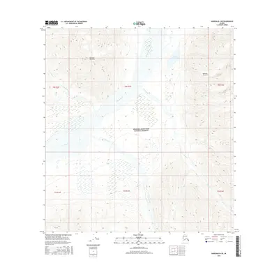
2016 Map of Nabesna B-4 NE
USGS Topo · Published 2016About this map
The Wrangell-Saint Elias National Preserve encompasses most of this 2016 terrain, illustrating a wild landscape where the Mentasta Mountains and Nutzotin Mountains converge. This area is dominated by the wide, braided corridor of the Nabesna River, which cuts through the center of the quadrangle. The map captures the complex hydrography of this subarctic environment, including the glacial-fed waters of Jimmy Brown Lake and several significant tributaries such as Totschunda Creek and Stone Creek. The lack of human structures or developed roads highlights the primitive nature of this protected interior Alaska wilderness. Land surveyors will note the precise Township and Range lines, including t8n r15e and t7n r15e, which provide the only formal grid across these high-elevation ridges and wetland valleys.
Find a feature on this map
16 named features on this map. Tap any name to fly to it.
Don’t see what you’re looking for? This feature index may not catch every label — zoom into the map to look around manually.
Map Details
Editions of this 2016 Nabesna B-4 NE Map
This is the sole edition of this map. No revisions or reprints were ever made.
Other maps of this area

1950 · Nabesna
USGS Topo · 1:250,000

1951 · Nabesna
USGS Topo · 1:250,000

1954 · Nabesna C-3
USGS Topo · 1:63,360

1955 · Nabesna C-3
USGS Topo · 1:63,360

1960 · Nabesna B-4
USGS Topo · 1:63,360

1960 · Nabesna
USGS Topo · 1:250,000

1960 · Nabesna C-4
USGS Topo · 1:63,360

1960 · Nabesna B-3
USGS Topo · 1:63,360
2016 · Nabesna B-4 NW
USGS Topo · 1:25,000
2016 · Nabesna B-4 SE
USGS Topo · 1:25,000