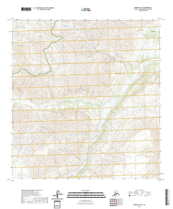
2023 Map of Nabesna B-5 SE
USGS Topo · Published 2023About this map
Nabesna stands near the northeastern edge of this high-elevation landscape, where the Wrangell Mountains meet the vast interior drainage systems. The terrain is defined by dramatic glacial and volcanic forms, with Gold Hill rising above the confluence of glacial meltwater streams. A complex network of waterways, including the broad path of Jacksina Creek and its tributaries like Wait Creek and Canyon Creek, carve through the valleys between steep ridges.
Find a feature on this map
14 named features on this map. Tap any name to fly to it.
Don’t see what you’re looking for? This feature index may not catch every label — zoom into the map to look around manually.
Map Details
Editions of this 2023 Nabesna B-5 SE Map
This is the sole edition of this map. No revisions or reprints were ever made.
Other maps of this area

1950 · Nabesna
USGS Topo · 1:250,000

1951 · Nabesna
USGS Topo · 1:250,000

1959 · Nabesna A-4
USGS Topo · 1:63,360

1959 · Nabesna A-5
USGS Topo · 1:63,360

1960 · Nabesna B-4
USGS Topo · 1:63,360

1960 · Nabesna B-5
USGS Topo · 1:63,360

1960 · Nabesna
USGS Topo · 1:250,000
2016 · Nabesna A-4 NW
USGS Topo · 1:25,000
2016 · Nabesna B-4 NW
USGS Topo · 1:25,000
2016 · Nabesna A-5 NW
USGS Topo · 1:25,000