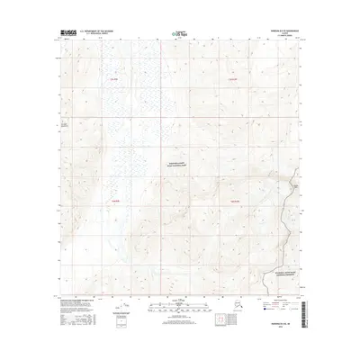
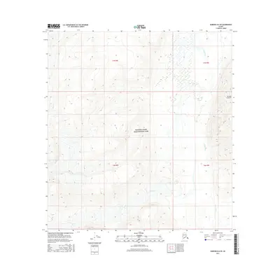
2016 Map of Nabesna B-6 SE
USGS Topo · Published 2016About this map
The high alpine country of the Wrangell Mountains defines this interior Alaskan landscape, dominated by the sprawling boundaries of Wrangell-Saint Elias National Park. Elevation reaches its local apex at Tanada Peak on the eastern edge of the quadrangle, with contour lines illustrating a steep ascent from the surrounding glacial valleys. The southeastern corner transitions into the Wrangell-Saint Elias National Preserve, a designation that reflects the complex federal land management within this wilderness area. The map shows a region devoid of roads or permanent settlements, where the terrain is marked by intricate drainage patterns and glacial features typical of the Copper River basin's headwaters. Detailed township and range grids, such as t7n r9e and t6n r10e, provide a structured overlay for this otherwise wild territory.
Find a feature on this map
8 named features on this map. Tap any name to fly to it.
Don’t see what you’re looking for? This feature index may not catch every label — zoom into the map to look around manually.
Map Details
Editions of this 2016 Nabesna B-6 SE Map
This is the sole edition of this map. No revisions or reprints were ever made.
Other maps of this area

1950 · Nabesna
USGS Topo · 1:250,000

1951 · Nabesna
USGS Topo · 1:250,000

1959 · Nabesna A-6
USGS Topo · 1:63,360

1959 · Nabesna A-5
USGS Topo · 1:63,360

1960 · Nabesna B-5
USGS Topo · 1:63,360

1960 · Nabesna
USGS Topo · 1:250,000
1960 · Nabesna B-6
USGS Topo · 1:63,360
2016 · Nabesna A-5 NW
USGS Topo · 1:25,000
2016 · Nabesna B-5 SW
USGS Topo · 1:25,000
2016 · Nabesna B-6 SW
USGS Topo · 1:25,000