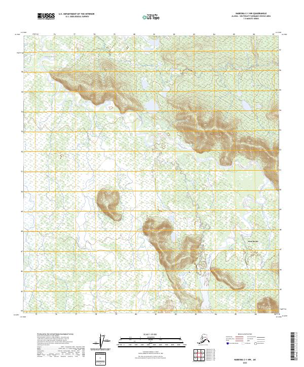
2023 Map of Nabesna C-1 NW
USGS Topo · Published 2023About this map
Chisana River winds through a vast expanse of wetlands and low-lying terrain within the Tetlin National Wildlife Refuge, characterizing this interior Alaska landscape. The area is defined by its complex drainage patterns, where the main river channel is joined by Scottie Creek amidst numerous unnamed ponds and marshy flats. The settlement of Alcan Border sits at the eastern edge of the quadrangle, serving as a rare point of human habitation in a region otherwise dominated by natural hydrology and protected wilderness. This 2023 survey illustrates the modern boundary between managed wildlife habitat and the border-crossing infrastructure, providing a precise record of the river's course and the surrounding alluvial features that dictate the movement of both water and wildlife in the Southeast Fairbanks region.
Find a feature on this map
8 named features on this map. Tap any name to fly to it.
Don’t see what you’re looking for? This feature index may not catch every label — zoom into the map to look around manually.
Map Details
Editions of this 2023 Nabesna C-1 NW Map
This is the sole edition of this map. No revisions or reprints were ever made.
Other maps of this area

1950 · Nabesna
USGS Topo · 1:250,000

1951 · Nabesna
USGS Topo · 1:250,000

1952 · Nabesna D-1
USGS Topo · 1:63,360

1954 · Nabesna D-2
USGS Topo · 1:63,360

1955 · Nabesna C-1
USGS Topo · 1:63,360

1955 · Nabesna C-2
USGS Topo · 1:63,360

1955 · Nabesna D-2
USGS Topo · 1:63,360

1960 · Nabesna
USGS Topo · 1:250,000
2013 · Nabesna D-1 SE
USGS Topo · 1:25,000
2013 · Nabesna C-1 NE
USGS Topo · 1:25,000