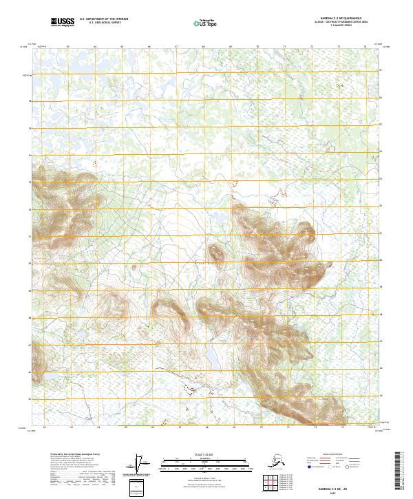
2023 Map of Nabesna C-2 NE
USGS Topo · Published 2023About this map
Tetlin National Wildlife Refuge encompasses the central and northern reaches of this topographic study, where a complex network of wetlands and low-lying drainages dominates the landscape. The geography is punctuated by the rising elevations of the Black Hills, which provide a distinct vertical contrast to the saturated terrain nearby. This remote portion of Alaska is characterized by the meandering path of Stuver Creek, which threads through both the upland slopes and the expansive marshlands. The mapping reflects a landscape largely defined by natural boundaries and the Public Land Survey System, illustrating the intersection of federally protected wilderness and the varied topography of the Tetlin National Wildlife Refuge in the early 21st century.
Find a feature on this map
7 named features on this map. Tap any name to fly to it.
Don’t see what you’re looking for? This feature index may not catch every label — zoom into the map to look around manually.
Map Details
Editions of this 2023 Nabesna C-2 NE Map
This is the sole edition of this map. No revisions or reprints were ever made.
Other maps of this area

1950 · Nabesna
USGS Topo · 1:250,000

1951 · Nabesna
USGS Topo · 1:250,000

1952 · Nabesna D-1
USGS Topo · 1:63,360

1954 · Nabesna D-2
USGS Topo · 1:63,360

1955 · Nabesna C-1
USGS Topo · 1:63,360

1955 · Nabesna C-2
USGS Topo · 1:63,360

1955 · Nabesna D-2
USGS Topo · 1:63,360

1960 · Nabesna
USGS Topo · 1:250,000
2016 · Nabesna C-2 NE
USGS Topo · 1:25,000
2016 · Nabesna C-1 NW
USGS Topo · 1:25,000