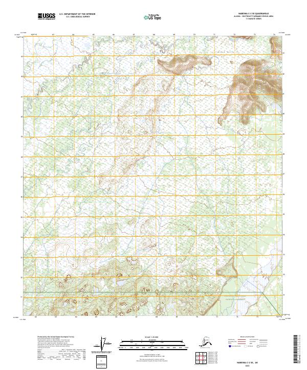
2023 Map of Nabesna C-2 SE
USGS Topo · Published 2023About this map
Tetlin National Wildlife Refuge dominates the interior of this topographic study, representing a vast expanse of subarctic wetlands and boreal forests in eastern Alaska. The landscape is characterized by intricate hydrographic patterns where Stuver Creek meanders across the northern reaches, while the southeast corner is defined by the broad path of the Chisana River. This glacial river system serves as a natural boundary near the northern edge of the Wrangell-Saint Elias National Preserve. Topographic relief is most pronounced in the northeast, where the Block Hills rise above the surrounding flats. The map illustrates the intersection of these two major federal conservation units, highlighting a wilderness area devoid of modern road infrastructure and defined by its natural drainage systems.
Find a feature on this map
11 named features on this map. Tap any name to fly to it.
Don’t see what you’re looking for? This feature index may not catch every label — zoom into the map to look around manually.
Map Details
Editions of this 2023 Nabesna C-2 SE Map
This is the sole edition of this map. No revisions or reprints were ever made.
Other maps of this area

1950 · Nabesna
USGS Topo · 1:250,000

1951 · Nabesna
USGS Topo · 1:250,000

1955 · Nabesna C-1
USGS Topo · 1:63,360

1955 · Nabesna C-2
USGS Topo · 1:63,360

1960 · Nabesna B-2
USGS Topo · 1:63,360

1960 · Nabesna
USGS Topo · 1:250,000

1960 · Nabesna B-1
USGS Topo · 1:63,360
2016 · Nabesna C-2 NE
USGS Topo · 1:25,000
2016 · Nabesna B-2 NE
USGS Topo · 1:25,000
2016 · Nabesna C-1 NW
USGS Topo · 1:25,000