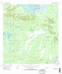
1955 Map of Nabesna C-2
USGS Topo · Published 1963About this map
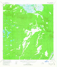
The Black Hills dominate the interior of this Alaskan subarctic landscape, forming a prominent upland divide amidst a complex network of wetlands and glacial lakes. This 1955 survey provides a clear view of the hydrography near the Chisana River, which cuts through the southeastern corner of the quadrangle. The terrain is defined by its numerous water bodies, including the large Tahamund Lake in the north and a cluster of basins to the west, such as Takomahto Lake, Jatahmund Lake, and Jatamund Lake. Drainage across the lowlands is facilitated by the winding course of Stuver Creek, which meanders between the hills. The map illustrates a transitional wilderness where the relief of the hills meets expansive swampy flats, a pattern common in the Copper River Meridian region during the mid-century period of topographical documentation.
Find a feature on this map
7 named features on this map. Tap any name to fly to it.
Don’t see what you’re looking for? This feature index may not catch every label — zoom into the map to look around manually.
Map Details
Editions of this 1955 Nabesna C-2 Map
3 editions found
Other maps of this area

1950 · Nabesna
USGS Topo · 1:250,000

1951 · Nabesna
USGS Topo · 1:250,000

1952 · Nabesna D-1
USGS Topo · 1:63,360

1954 · Nabesna D-2
USGS Topo · 1:63,360

1954 · Nabesna D-3
USGS Topo · 1:63,360

1954 · Nabesna C-3
USGS Topo · 1:63,360

1955 · Nabesna C-1
USGS Topo · 1:63,360

1955 · Nabesna C-2
USGS Topo · 1:63,360

1955 · Nabesna D-3
USGS Topo · 1:63,360

1955 · Nabesna C-3
USGS Topo · 1:63,360