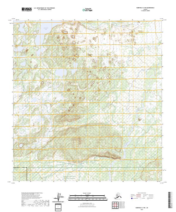
2023 Map of Nabesna C-2 SW
USGS Topo · Published 2023About this map
Tetlin National Wildlife Refuge and the Wrangell-Saint Elias National Preserve meet in this interior Alaskan wilderness, where the landscape is defined by extensive wetlands and complex hydraulic networks. The northern portion of the map is dominated by the broad waters of Jatahmund Lake and Takomahto Lake, which transition into a dense mosaic of smaller water bodies and marshlands characteristic of the Tanana River valley's glacial legacy.
Find a feature on this map
13 named features on this map. Tap any name to fly to it.
Don’t see what you’re looking for? This feature index may not catch every label — zoom into the map to look around manually.
Map Details
Editions of this 2023 Nabesna C-2 SW Map
This is the sole edition of this map. No revisions or reprints were ever made.
Other maps of this area

1950 · Nabesna
USGS Topo · 1:250,000

1951 · Nabesna
USGS Topo · 1:250,000

1954 · Nabesna C-3
USGS Topo · 1:63,360

1955 · Nabesna C-2
USGS Topo · 1:63,360

1955 · Nabesna C-3
USGS Topo · 1:63,360

1960 · Nabesna B-2
USGS Topo · 1:63,360

1960 · Nabesna
USGS Topo · 1:250,000

1960 · Nabesna B-3
USGS Topo · 1:63,360
2016 · Nabesna C-2 NE
USGS Topo · 1:25,000
2016 · Nabesna B-2 NE
USGS Topo · 1:25,000