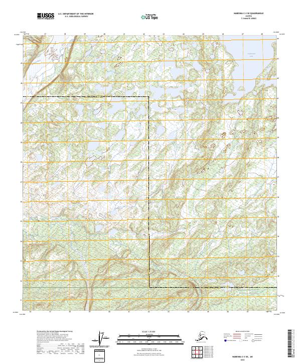
2023 Map of Nabesna C-3 SE
USGS Topo · Published 2023About this map
Tetlin National Wildlife Refuge occupies much of this sub-Arctic landscape, dominated by a dense network of wetlands, small ponds, and complex drainage systems. The Nabesna River flows through the northwest corner, while the eastern boundary is marked by the expansive waters of Jatahmund Lake. This map captures a remote section of the Alaska interior where the Southeast Fairbanks Census Area meets the Copper River Census Area. The southern margin reveals the transition into the Wrangell-Saint-Elias National Preserve, showing a terrain largely defined by glacial hydrology and untouched wilderness. Notable watercourses like Lick Creek wind through the interior, illustrating the seasonal water patterns of the Upper Tanana valley.
Find a feature on this map
12 named features on this map. Tap any name to fly to it.
Don’t see what you’re looking for? This feature index may not catch every label — zoom into the map to look around manually.
Map Details
Editions of this 2023 Nabesna C-3 SE Map
This is the sole edition of this map. No revisions or reprints were ever made.
Other maps of this area

1950 · Nabesna
USGS Topo · 1:250,000

1951 · Nabesna
USGS Topo · 1:250,000

1954 · Nabesna C-3
USGS Topo · 1:63,360

1955 · Nabesna C-2
USGS Topo · 1:63,360

1955 · Nabesna C-3
USGS Topo · 1:63,360

1960 · Nabesna B-2
USGS Topo · 1:63,360

1960 · Nabesna
USGS Topo · 1:250,000

1960 · Nabesna B-3
USGS Topo · 1:63,360
2016 · Nabesna C-2 SW
USGS Topo · 1:25,000
2016 · Nabesna B-2 NW
USGS Topo · 1:25,000