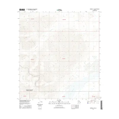
2016 Map of Nabesna C-4 SE
USGS Topo · Published 2016About this map
Wrangell-Saint Elias National Preserve encompasses much of this landscape, where the high-altitude terrain is defined by the winding paths of glacial melt and alpine drainage. The Cheslina River flows across the northern reaches, while the southeastern corner is shaped by the broad valley of the Nabesna River. A dense network of contour lines illustrates the sharp elevation changes between these river basins and the surrounding peaks. In the southwestern quadrant, Totschunda Cr carves through the protected lands, highlighting the preserved wilderness state of this interior region during the early twenty-first century.
Find a feature on this map
11 named features on this map. Tap any name to fly to it.
Don’t see what you’re looking for? This feature index may not catch every label — zoom into the map to look around manually.
Map Details
Editions of this 2016 Nabesna C-4 SE Map
This is the sole edition of this map. No revisions or reprints were ever made.
Other maps of this area

1950 · Nabesna
USGS Topo · 1:250,000

1951 · Nabesna
USGS Topo · 1:250,000

1954 · Nabesna C-3
USGS Topo · 1:63,360

1955 · Nabesna C-3
USGS Topo · 1:63,360

1960 · Nabesna B-4
USGS Topo · 1:63,360

1960 · Nabesna
USGS Topo · 1:250,000

1960 · Nabesna C-4
USGS Topo · 1:63,360

1960 · Nabesna B-3
USGS Topo · 1:63,360
2016 · Nabesna C-4 NW
USGS Topo · 1:25,000
2016 · Nabesna B-4 NW
USGS Topo · 1:25,000