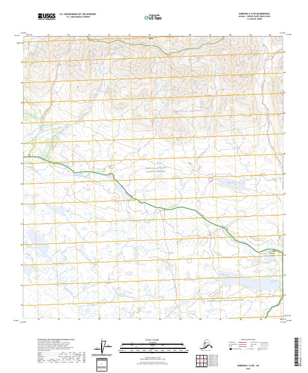
2023 Map of Nabesna C-5 SW
USGS Topo · Published 2023About this map
The Mentasta Mountains dominate the northern terrain of this landscape, giving way to a wetland-heavy basin in the south where Wrangell-Saint Elias National Preserve meets the Wrangell-Saint Elias National Park. The central corridor is defined by Nabesna Road, a vital artery through this wilderness that connects remote outposts and provides access to various backcountry trails. Numerous water bodies and drainage systems, including Jack Lake, Twin Lakes, and the winding Tanada Creek, create a complex hydrologic network. The presence of the Sportsmans Paradise Airport near the eastern boundary highlights the area's reliance on bush aviation for access. To the north, the small settlement of Slana sits at the edge of the mountain range, serving as a gateway to the surrounding preserve. This region's character is shaped by the transition from high mountain peaks to the vast, water-saturated lowlands typical of the Copper River Basin.
Find a feature on this map
26 named features on this map. Tap any name to fly to it.
Don’t see what you’re looking for? This feature index may not catch every label — zoom into the map to look around manually.
Map Details
Editions of this 2023 Nabesna C-5 SW Map
This is the sole edition of this map. No revisions or reprints were ever made.
Other maps of this area

1948 · Nabesna C-6
USGS Topo · 1:63,360

1950 · Nabesna
USGS Topo · 1:250,000

1951 · Nabesna
USGS Topo · 1:250,000

1952 · Nabesna C-6
USGS Topo · 1:63,360

1957 · Nabesna C-5
USGS Topo · 1:63,360

1960 · Nabesna B-5
USGS Topo · 1:63,360

1960 · Nabesna
USGS Topo · 1:250,000
1960 · Nabesna B-6
USGS Topo · 1:63,360
1960 · Nabesna C-5
USGS Topo · 1:63,360
2016 · Nabesna C-6 NE
USGS Topo · 1:25,000