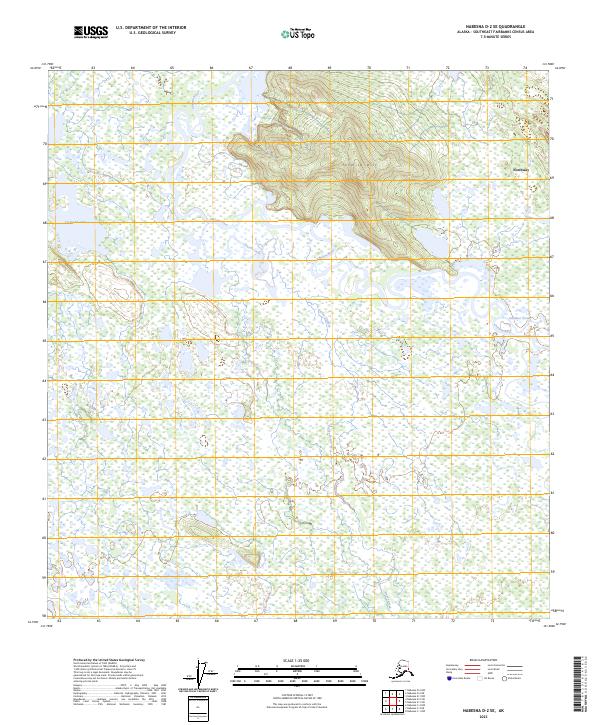
2023 Map of Nabesna D-2 SE
USGS Topo · Published 2023About this map
Northway sits in the northeast corner of this map, positioned near the meandering waters of the Chisana River. The landscape is dominated by the sprawling wetlands and braided water channels of the Tetlin National Wildlife Refuge, which covers the southern and central portions of the quadrangle. North of the river, the terrain rises toward Tenmile Hill, providing a distinct topographical contrast to the low-lying river basin. The complex water system includes Tsolmund Lake to the west and numerous unnamed ponds and sloughs that define the region's character. Significant tributaries like Stuver Creek and Gardiner Creek feed into the main river system, illustrating the intricate drainage patterns of this Alaskan interior region. The map captures the interface between the elevated hills and the saturated lowlands that support the local ecosystem.
Find a feature on this map
14 named features on this map. Tap any name to fly to it.
Don’t see what you’re looking for? This feature index may not catch every label — zoom into the map to look around manually.
Map Details
Editions of this 2023 Nabesna D-2 SE Map
This is the sole edition of this map. No revisions or reprints were ever made.
Other maps of this area

1950 · Nabesna
USGS Topo · 1:250,000

1951 · Nabesna
USGS Topo · 1:250,000

1952 · Nabesna D-1
USGS Topo · 1:63,360

1954 · Nabesna D-2
USGS Topo · 1:63,360

1955 · Nabesna C-1
USGS Topo · 1:63,360

1955 · Nabesna C-2
USGS Topo · 1:63,360

1955 · Nabesna D-2
USGS Topo · 1:63,360

1960 · Nabesna
USGS Topo · 1:250,000
2016 · Nabesna D-2 NW
USGS Topo · 1:25,000
2016 · Nabesna C-2 NE
USGS Topo · 1:25,000