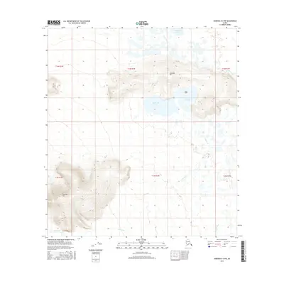
2016 Map of Nabesna D-3 NW
USGS Topo · Published 2016About this map
The Tetlin River meanders through this interior Alaska landscape, defining a complex system of wetlands and waterways. The terrain is characterized by isolated elevations and expansive low-lying basins, where the river links prominent water bodies such as Halthmund Lake and Chindagmund Lake. These lakes are centered around Titus Island, a distinct feature amidst the surrounding marshy plains. To the north and west, the topography rises into several significant landmarks, including Halthalda Hill and the prominent Kinshuda Hill. The map provides a detailed view of these natural formations and the Kalukna River drainage system during the early twenty-first century. This survey documents the untouched hydrology of the Unorganized Borough, where the intricate network of streams and hills reflects the undisturbed character of the Alaskan interior.
Find a feature on this map
13 named features on this map. Tap any name to fly to it.
Don’t see what you’re looking for? This feature index may not catch every label — zoom into the map to look around manually.
Map Details
Editions of this 2016 Nabesna D-3 NW Map
This is the sole edition of this map. No revisions or reprints were ever made.
Other maps of this area

1948 · Tanacross A-3
USGS Topo · 1:63,360

1948 · Tanacross A-4
USGS Topo · 1:63,360

1949 · Tanacross
USGS Topo · 1:250,000

1950 · Tanacross
USGS Topo · 1:250,000

1950 · Nabesna
USGS Topo · 1:250,000

1951 · Nabesna
USGS Topo · 1:250,000

1952 · Tanacross A-4
USGS Topo · 1:63,360

1952 · Tanacross A-3
USGS Topo · 1:63,360

1954 · Nabesna D-3
USGS Topo · 1:63,360

1954 · Nabesna D-4
USGS Topo · 1:63,360