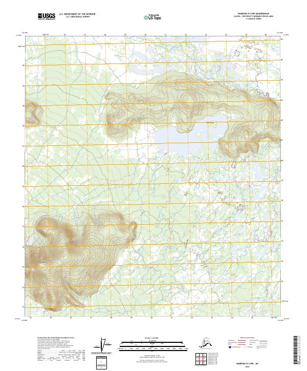
2023 Map of Nabesna D-3 NW
USGS Topo · Published 2023About this map
Tetlin River meanders across this interior Alaskan landscape, defining the low-lying drainage patterns between prominent elevations. The terrain is anchored by the significant heights of Halthalaa Hill in the north and Kinshuda Hill to the southwest, providing a stark vertical contrast to the surrounding wetlands and river plains. Centrally, Titus Island sits as a distinct landform within the water system, illustrating the complex hydrography of the region. This 2023 survey by the U.S. Geological Survey details the expansive wilderness within the Southeast Fairbanks Census Area, where natural features rather than human infrastructure dominate the landscape.
Find a feature on this map
10 named features on this map. Tap any name to fly to it.
Don’t see what you’re looking for? This feature index may not catch every label — zoom into the map to look around manually.
Map Details
Editions of this 2023 Nabesna D-3 NW Map
This is the sole edition of this map. No revisions or reprints were ever made.
Other maps of this area

1948 · Tanacross A-3
USGS Topo · 1:63,360

1948 · Tanacross A-4
USGS Topo · 1:63,360

1949 · Tanacross
USGS Topo · 1:250,000

1950 · Tanacross
USGS Topo · 1:250,000

1950 · Nabesna
USGS Topo · 1:250,000

1951 · Nabesna
USGS Topo · 1:250,000

1952 · Tanacross A-4
USGS Topo · 1:63,360

1952 · Tanacross A-3
USGS Topo · 1:63,360

1954 · Nabesna D-3
USGS Topo · 1:63,360

1954 · Nabesna D-4
USGS Topo · 1:63,360