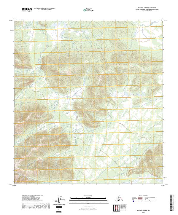
2023 Map of Nabesna D-4 NE
USGS Topo · Published 2023About this map
Clearwater Creek flows through the northeast corner of this interior Alaskan landscape, a region defined by high elevations and dramatic relief. The terrain is characterized by the headwaters of numerous small drainages, including Bear Creek and Mice Creek, which carve through the undeveloped wilderness of the Southeast Fairbanks Census Area. These waterways suggest a landscape shaped by seasonal snowmelt and glacial runoff, typical of the high-latitude interior. The absence of roads or established settlements underscores the territory's role as a remote frontier, primarily organized by the Public Land Survey System coordinates of t14n r14e and t14n r15e. This map offers a technical look at the land's contours and hydrologic patterns as they existed in the early twenty-first century.
Find a feature on this map
7 named features on this map. Tap any name to fly to it.
Don’t see what you’re looking for? This feature index may not catch every label — zoom into the map to look around manually.
Map Details
Editions of this 2023 Nabesna D-4 NE Map
This is the sole edition of this map. No revisions or reprints were ever made.
Other maps of this area

1948 · Tanacross A-3
USGS Topo · 1:63,360

1948 · Tanacross A-4
USGS Topo · 1:63,360

1949 · Tanacross
USGS Topo · 1:250,000

1950 · Tanacross
USGS Topo · 1:250,000

1950 · Nabesna
USGS Topo · 1:250,000

1951 · Nabesna
USGS Topo · 1:250,000

1952 · Tanacross A-4
USGS Topo · 1:63,360

1952 · Tanacross A-3
USGS Topo · 1:63,360

1954 · Nabesna D-3
USGS Topo · 1:63,360

1954 · Nabesna D-4
USGS Topo · 1:63,360