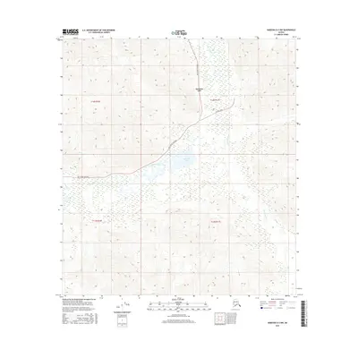
2016 Map of Nabesna D-5 NW
USGS Topo · Published 2016About this map
Mentasta Lake serves as the primary focal point of this interior Alaskan landscape, situated along the critical transportation corridor of the Tok Cutoff Highway. The map illustrates a region defined by high-altitude wetlands and glacial drainage patterns, where the Little Tok River and Mentasta Cr wind through the valley floor. The presence of 91 Mile Loop near the lakeshore suggests a localized network of access roads branching off the main highway, supporting the small settlement and its surrounding seasonal activities. To the south of the main village, Mineral Lake and the drainage of Snowshoe Cr further characterize the intricate hydrography of the Mentasta Mountains region, providing a detailed record of the terrain and infrastructure as it existed in 2016.
Find a feature on this map
11 named features on this map. Tap any name to fly to it.
Don’t see what you’re looking for? This feature index may not catch every label — zoom into the map to look around manually.
Map Details
Editions of this 2016 Nabesna D-5 NW Map
This is the sole edition of this map. No revisions or reprints were ever made.
Other maps of this area

1948 · Tanacross A-6
USGS Topo · 1:63,360

1948 · Nabesna D-5
USGS Topo · 1:63,360

1948 · Tanacross A-5
USGS Topo · 1:63,360

1949 · Tanacross
USGS Topo · 1:250,000

1949 · Nabesna D-6
USGS Topo · 1:63,360

1949 · Tanacross A-5
USGS Topo · 1:63,360

1950 · Tanacross
USGS Topo · 1:250,000

1950 · Nabesna
USGS Topo · 1:250,000

1950 · Nabesna D-5
USGS Topo · 1:63,360

1951 · Nabesna
USGS Topo · 1:250,000