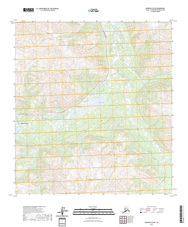
2023 Map of Nabesna D-5 NW
USGS Topo · Published 2023About this map
The Mentasta Mountains dominate the southern half of this landscape, rising above a network of waterways that define the northern Copper River Census Area. The Tok Cutoff Highway provides the primary transit artery through the valley, passing the junction of Mentasta Lake and the feeder waters of Mentasta Creek. This interior terrain is characterized by a high concentration of wetlands and lakes, with Mineral Lake occupying a central basin north of the highway. The hydrology here is complex, as several drainages converge including the Little Tok River and Snowshoe Creek. To the northeast, the presence of the 91 Mile Loop and Trail Creek suggests established routes through the river corridor, highlighting the essential relationship between the highway system and the natural waterways in this portion of the Alaska interior.
Find a feature on this map
13 named features on this map. Tap any name to fly to it.
Don’t see what you’re looking for? This feature index may not catch every label — zoom into the map to look around manually.
Map Details
Editions of this 2023 Nabesna D-5 NW Map
This is the sole edition of this map. No revisions or reprints were ever made.
Other maps of this area

1948 · Tanacross A-6
USGS Topo · 1:63,360

1948 · Nabesna D-5
USGS Topo · 1:63,360

1948 · Tanacross A-5
USGS Topo · 1:63,360

1949 · Tanacross
USGS Topo · 1:250,000

1949 · Nabesna D-6
USGS Topo · 1:63,360

1949 · Tanacross A-5
USGS Topo · 1:63,360

1950 · Tanacross
USGS Topo · 1:250,000

1950 · Nabesna
USGS Topo · 1:250,000

1950 · Nabesna D-5
USGS Topo · 1:63,360

1951 · Nabesna
USGS Topo · 1:250,000