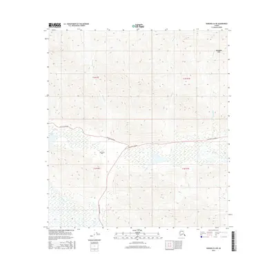
2016 Map of Nabesna D-6 NE
USGS Topo · Published 2016About this map
Mentasta Pass serves as a critical geographic gateway through the high terrain of the Unorganized Borough, providing a corridor for both water and transport. The Tok Cutoff Highway snakes through this low-lying gap, following the path established by Mentasta Cr as it flows south toward the Slana River system. The presence of Mentasta Lake and the branching Mentasta Spur Road indicates the importance of this specific mountain passage for connectivity in the eastern Alaska interior. To the south, the landscape opens into the wetlands of Slana Slough, where numerous smaller drainages like Mabel Cr and Snowshoe Cr converge. This map documents a region where the human footprint is strictly defined by the topography, with infrastructure clinging to the narrow habitable valleys between steep ridges.
Find a feature on this map
14 named features on this map. Tap any name to fly to it.
Don’t see what you’re looking for? This feature index may not catch every label — zoom into the map to look around manually.
Map Details
Editions of this 2016 Nabesna D-6 NE Map
This is the sole edition of this map. No revisions or reprints were ever made.
Other maps of this area

1948 · Tanacross A-6
USGS Topo · 1:63,360

1948 · Nabesna D-5
USGS Topo · 1:63,360

1948 · Tanacross A-5
USGS Topo · 1:63,360

1949 · Tanacross
USGS Topo · 1:250,000

1949 · Nabesna D-6
USGS Topo · 1:63,360

1949 · Tanacross A-5
USGS Topo · 1:63,360

1950 · Tanacross
USGS Topo · 1:250,000

1950 · Nabesna
USGS Topo · 1:250,000

1950 · Nabesna D-5
USGS Topo · 1:63,360

1951 · Nabesna
USGS Topo · 1:250,000