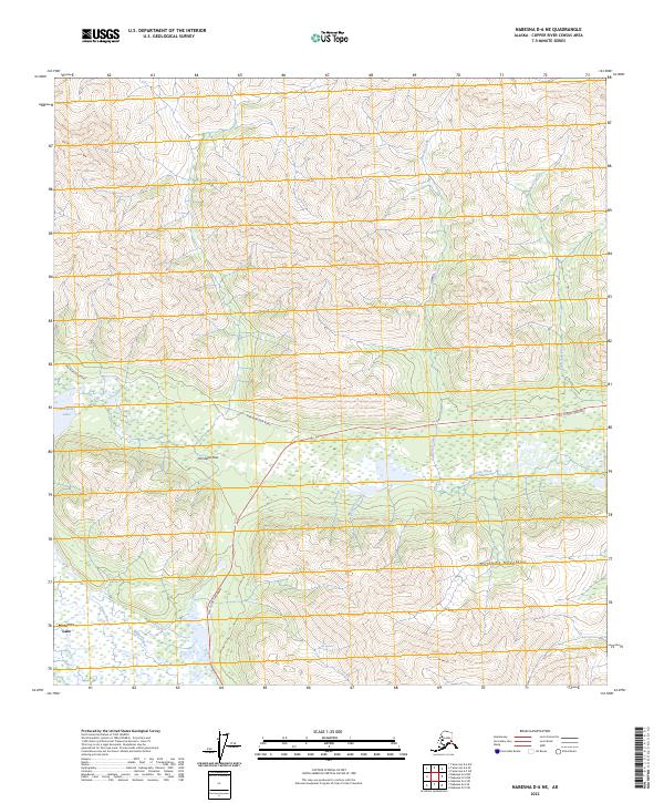
2023 Map of Nabesna D-6 NE
USGS Topo · Published 2023About this map
Mentasta Pass serves as a vital corridor through the high terrain of the Mentasta Mountains, anchoring a landscape where modern transit meets traditional waterways. The Tok Cutoff Highway and Mentasta Spur Road track through this mountain gap, mirroring the natural passage provided by the headwaters of the Slana River. The eastern shores of Mentasta Lake dominate the western edge of the sheet, providing a focal point for the numerous drainage systems, including Bartell Creek, Mentasta Creek, and Snowshoe Creek, which define the local topography. This 2023 survey illustrates the continued importance of these mountain passes in connecting the Alaskan interior, showing how infrastructure remains concentrated along the narrow habitable valleys between steep peaks.
Find a feature on this map
14 named features on this map. Tap any name to fly to it.
Don’t see what you’re looking for? This feature index may not catch every label — zoom into the map to look around manually.
Map Details
Editions of this 2023 Nabesna D-6 NE Map
This is the sole edition of this map. No revisions or reprints were ever made.
Other maps of this area

1948 · Tanacross A-6
USGS Topo · 1:63,360

1948 · Nabesna D-5
USGS Topo · 1:63,360

1948 · Tanacross A-5
USGS Topo · 1:63,360

1949 · Tanacross
USGS Topo · 1:250,000

1949 · Nabesna D-6
USGS Topo · 1:63,360

1949 · Tanacross A-5
USGS Topo · 1:63,360

1950 · Tanacross
USGS Topo · 1:250,000

1950 · Nabesna
USGS Topo · 1:250,000

1950 · Nabesna D-5
USGS Topo · 1:63,360

1951 · Nabesna
USGS Topo · 1:250,000