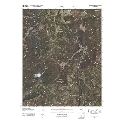
2011 Map of Nacimiento Peak
USGS Topo · Published 2011About this map
San Gregorio Reservoir and its associated San Gregorio Reservoir Dam dominate the western high country in this 2011 survey of the San Pedro Mountains. This drainage basin serves as the headwaters for numerous alpine streams, including Rio Puerco, Rio de las Vacas, and Rito de las Palomas, which carve through the high-elevation meadows of San Pedro Parks. The landscape is defined by its transition from prominent peaks like Nacimiento Peak and San Pedro Peaks to the lower elevation Eureka Mesa and Cañon Madera. Cultural markings are sparse in this protected area, though the presence of San Pedro Cabin and Vallecito Damian indicates long-standing seasonal use. Modern recreational infrastructure is visible at the Nacimiento Campground, while the network of forest roads, such as Forest Rd 70, provides the primary access to Parque Venado and American Park.
Find a feature on this map
34 named features on this map. Tap any name to fly to it.
Don’t see what you’re looking for? This feature index may not catch every label — zoom into the map to look around manually.
Map Details
Editions of this 2011 Nacimiento Peak Map
This is the sole edition of this map. No revisions or reprints were ever made.
Other maps of this area

1890 · Jemes
USGS Topo · 1:125,000

1892 · Jemes
USGS Topo · 1:125,000

1909 · Gallina
USGS Topo · 1:125,000

1937 · Jemez Springs
USGS Topo · 1:48,000

1939 · La Ventana
USGS Topo · 1:62,500

1940 · Cuba
USGS Topo · 1:62,500

1943 · Cuba
USGS Topo · 1:62,500

1943 · La Ventana
USGS Topo · 1:62,500

1944 · Jemez Springs
USGS Topo · 1:62,500

1952 · Jemez Springs
USGS Topo · 1:62,500