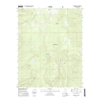
2017 Map of Nacimiento Peak
USGS Topo · Published 2017About this map
Nacimiento Peak and the high elevations of the San Pedro Mountains dominate this high-altitude landscape within the Santa Fe National Forest. The geography is defined by a dense network of drainages and named summits, including San Pedro Peaks in the north and the prominent Eureka Mesa to the southwest. Water resources are central to the area's layout, with the San Gregorio Reservoir serving as a significant landmark alongside numerous alpine creeks such as the Rio de las Vacas and Rio Puerco.
Find a feature on this map
35 named features on this map. Tap any name to fly to it.
Don’t see what you’re looking for? This feature index may not catch every label — zoom into the map to look around manually.
Map Details
Editions of this 2017 Nacimiento Peak Map
This is the sole edition of this map. No revisions or reprints were ever made.
Other maps of this area

1890 · Jemes
USGS Topo · 1:125,000

1892 · Jemes
USGS Topo · 1:125,000

1909 · Gallina
USGS Topo · 1:125,000

1937 · Jemez Springs
USGS Topo · 1:48,000

1939 · La Ventana
USGS Topo · 1:62,500

1940 · Cuba
USGS Topo · 1:62,500

1943 · Cuba
USGS Topo · 1:62,500

1943 · La Ventana
USGS Topo · 1:62,500

1944 · Jemez Springs
USGS Topo · 1:62,500

1952 · Jemez Springs
USGS Topo · 1:62,500