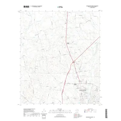
2019 Map of Nacogdoches North
USGS Topo · Published 2019About this map
Nacogdoches and its northern outskirts are defined by the convergence of creek systems like Banita Cr and Bayou La Nana, which have shaped the settlement patterns of Nacogdoches County. The map documents several historical rural communities such as Mahl, Central Heights, and Redfield, showing the transition from the denser urban core to the surrounding agricultural and timbered lands. Genealogists will find a high concentration of burial sites throughout the landscape, including the Old North Cem, Hayter Cem, and Stone Cem, often located near early road junctions or family landholdings. Water features like the Robert W Murphey Lake and the Nacogdoches Springs near the town center highlight the area's natural hydrography, while the Lanana Creek Trail follows the corridor of one of the region's primary waterways.
Find a feature on this map
119 named features on this map. Tap any name to fly to it.
Don’t see what you’re looking for? This feature index may not catch every label — zoom into the map to look around manually.
Map Details
Editions of this 2019 Nacogdoches North Map
This is the sole edition of this map. No revisions or reprints were ever made.
Other maps of this area

1943 · Cushing
USGS Topo · 1:62,500

1945 · Cushing
USGS Topo · 1:62,500

1952 · Douglass
USGS Topo · 1:62,500

1952 · Nacogdoches
USGS Topo · 1:62,500

1953 · Palestine
USGS Topo · 1:250,000

1957 · Palestine
USGS Topo · 1:250,000

1960 · Mount Enterprise
USGS Topo · 1:62,500

1973 · Cushing
USGS Topo · 1:24,000
1983 · Nacogdoches South
USGS Topo · 1:24,000
1983 · Lake Nacogdoches North
USGS Topo · 1:24,000